
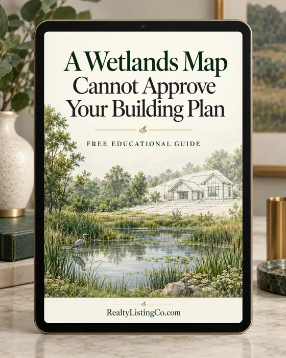
A Wetlands Map Cannot Approve Your Building Plan
Use mapped wet areas to prepare a site-specific review before relying on a layout.
- 2 min read
- 4 clear steps
- Printable checklist
- Free PDF
By RealtyListingCo · Published October 31, 2026 · Reviewed October 31, 2026
Prepare a dated map packet and a short list of location-specific questions for the relevant authorities and a qualified wetlands professional.
- Keep each map tied to its sourceSave the map name, date, legend, scale and parcel reference.
- Show the work you are actually consideringMark approximate locations for buildings, access, grading, fill and utilities on a separate concept sketch.
- Ask what field evidence is neededEPA describes wetlands identification using vegetation, soils and hydrology.
- Connect unanswered questions to your decision dateList the review scope, expected response date, person responsible and any contract date affected.
Uncertain Wet Areas and Proposed Construction
A parcel map appears to leave room for a house, driveway and wastewater system. That picture can help you ask questions, but it cannot confirm where regulated waters begin or whether the proposed work is allowed. Start by identifying which parts of your plan still depend on an actual site review.
§ 1 Step 1 of 4 Keep each map tied to its source
Save the map name, date, legend, scale and parcel reference. Mark whether a line came from a public viewer, seller sketch or professional report. Do not merge those lines into one apparently authoritative drawing. A missing map feature is a question to investigate, not proof that the feature is absent.
§ 2 Step 2 of 4 Show the work you are actually considering
Mark approximate locations for buildings, access, grading, fill and utilities on a separate concept sketch. Label every location provisional. Ask which parts of the work require further review and whether state, tribal or local requirements apply in addition to any federal process.
§ 3 Step 3 of 4 Ask what field evidence is needed
EPA describes wetlands identification using vegetation, soils and hydrology. Ask the appropriate agency and qualified professional what investigation, documentation and determinations are needed for this parcel. A dry visit cannot replace that work. Do not disturb soil, vegetation or drainage to make a site appear drier.
§ 4 Step 4 of 4 Connect unanswered questions to your decision date
List the review scope, expected response date, person responsible and any contract date affected. Ask your own attorney about transaction options before a deadline passes. Leave construction area, costs and schedule unresolved until the necessary evidence is available.
A Practical Example
Illustrative example: A buyer sketches a driveway across a low strip between the road and a proposed home site. Instead of assuming the unshaded strip is clear, the buyer sends the dated map and concept sketch for professional review. The driveway route remains provisional while the review is arranged.
Illustrative example, not a case history or a recommended legal outcome.
When to get help
Use a qualified wetlands professional and the responsible agencies. Ask a local land-use attorney about restrictions and contract consequences. This preparation exercise is not a delineation or permitting determination.
Your next step checklist
One thing to do today: Save one dated map and write down the first proposed activity that could affect a wet area.
Ticks stay on this page while you read. Print to keep a copy.
One thing to do today: Save one dated map and write down the first proposed activity that could affect a wet area.
Appendix B · Sources & further reading
- US Fish & Wildlife Service — Wetlands Map Limitations. . www.fws.gov
- EPA — Wetlands Identification and CWA Section 404. . www.epa.gov
Sources last reviewed October 31, 2026
Your next step depends on your situation
Checklist preview
Your next step checklist
- Save map dates and legends
- Identify the exact parcel
- Mark proposed disturbance separately
2 more checklist items in the guide.
Your free printable guide
Keep This Guide and Checklist Handy.
A Wetlands Map Cannot Approve Your Building Plan
Use mapped wet areas to prepare a site-specific review before relying on a layout.
Download the Free Guide & Checklist3-page printable PDF with the guide, checklist and sources. Downloads in your browser. No email, account or purchase required.
Optional: Get Land & Acreage Guide Updates
Get new free guides and practical planning tips, including land & acreage topics, plus occasional product offers. Downloading or printing does not subscribe you.
Raw Land Cost Calculator
Explore an illustrative estimate alongside the questions in this guide.
More Land & Acreage guides All Land & Acreage guides →
Before You Buy Land, Start With These Five Checks
Read the guide →A Road to the Parcel Is Not the Whole Access Answer
Organize the records and questions that help a title professional, attorney and surveyor review access to a parcel.
Read the guide →Buying Land With Unanswered Well and Septic Questions
Separate available records, site evaluations and approvals so early information is not mistaken for a final answer.
Read the guide →The Land Price Is Only One Part of the Budget
Bring separate provider estimates into one planning record without treating unknown costs as zero or assuming financing is available.
Read the guide →Can You Use the Land the Way You Want?
Turn a vague plan for a parcel into specific zoning and restriction questions before committing to a purchase.
Read the guide →A Dry Site Visit Does Not Answer Every Flood-Risk Question
Use flood information to prepare local questions before relying on a parcel’s appearance or a listing description.
Read the guide →Will Reliable Internet Reach Your Rural Property?
Compare what providers can actually install at a particular parcel before relying on an advertised coverage area.
Read the guide →Can Construction Deliveries Reach Your Rural Building Site?
Prepare a carrier and contractor discussion about getting materials onto rural property.
Read the guide →Buying a Property With a Shared Well: What Is Still Unclear?
Assemble shared-well records and unanswered operating questions before a purchase or ownership discussion.
Read the guide →Why Two Rural Utility Quotes May Not Be Comparable
Compare rural utility installation quotes on a consistent scope rather than headline price alone.
Read the guide →How to Ask for Acreage Maintenance Without a Vague Quote
Turn recurring property upkeep into a service scope and seasonal review list.
Read the guide →Put the guide into practice Explore Land & Acreage resources →
 Land and Acreage Buyer Due Diligence Workbook See current formats View details →
 Land Zoning Access and Easement Questions Workbook See current formats View details →
 Rural Well Septic and Utility Review Workbook See current formats View details →
 Land Financing and Site Cost Questions Workbook See current formats View details →
A note on professional advice. This guide is general education, not legal, financial or tax advice. Requirements vary by jurisdiction, documents and individual circumstances. Consult appropriately qualified local professionals before consequential decisions or signatures. Observations, maps and planning lists do not verify legal access, boundaries, water rights, wastewater suitability, zoning, permits or buildability. This is not engineering, environmental, electrical or construction advice. Consult relevant local authorities and qualified legal and technical professionals before buying, signing, disturbing land or beginning work. Read our full Educational Disclaimer.
The Reading Room · RealtyListingCo · Free educational guides